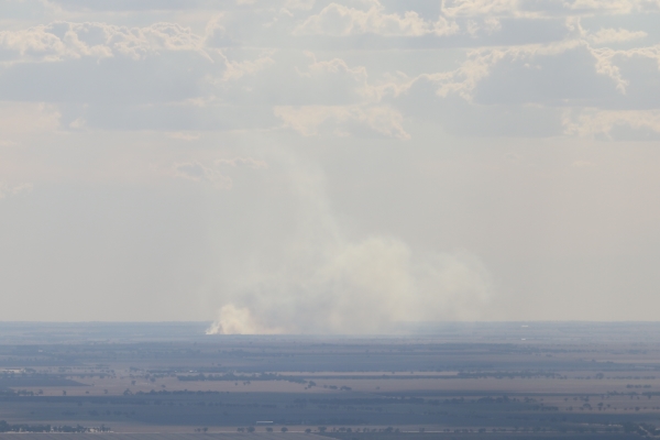
A planned burn in the Southern Break of the Central Block of the Little Desert National Park, which was postponed last week, will go ahead tomorrow, weather conditions permitting.
The burn will occur in a 100 hectare area that is 13 kilometres north of Goroke.
The burn, which is set to begin on Thursday, is expected to last until Sunday evening.
Wimmera Acting District Manager Glenn Rudolph said that "this Southern Break Track burn, north of Goroke, will be the first of several similar burns to be carried out within the Little Desert National Park over the next three months.
"These edge and internal break burns are conducted along the edges and within small, defined sections of the park to create strategic firebreaks," Mr Rudolph said.
"Like all Mallee bush landscapes, the Little Desert National Park is particularly fire-prone.
"Potentially, large and intense wildfires can burn thousands of hectares and dramatically affect the vegetation and wildlife habitats.
"Edge break burning is designed to reduce fuel to lessen the spread and intensity of bushfires originating in the Little Desert National Park, burning wildlife habitat and escaping into surrounding agricultural communities.
"For example, one species that will benefit from this type of burning is the threatened Malleefowl, which relies on long unburnt habitat for breeding.
"Smoke from the Little Desert National Park burning program may be visible along the Wimmera Highway/Natimuk-Frances Road to the south; along Nhill-Yanac Road/Western Highway to the north; and from all surrounding townships such as Horsham, Dimboola, Nhill, Kaniva, Natimuk and Goroke.
"During planned burning, the safety of firefighters and the public is our highest priority.
"We take all possible precautions to ensure people do not enter areas where planned burns are occurring or where a planned burn has recently been conducted until the area is safe.
"Planned burns can only go ahead when weather conditions are suitable, so our plans may change."
What to do
Be aware of planned burns happening in your local area and stay clear of areas where burns are
taking place or in areas that have recently been burned.
If you are experiencing any symptoms that may be due to smoke exposure, the Department of Health
advises that you should seek medical advice or call Nurse on Call on 1300 606 024.
Road Users
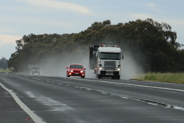
Road travel may be hazardous due to low visibility associated with smoke;
Signs may be in place to slow traffic. Obey all traffic signs and instructions from fire agency crews near the burn.
For travel times and roadworks, check http://traffic.vicroads.vic.gov.au
Forest/Park Recreation Sites
Access to walking tracks, car parks, camping grounds and picnic sites in the areas close to or in burn areas may be restricted
For park closures, please refer to Parks Victoria on 13 19 63 or visit www.parkweb.vic.gov.au.
Smoke and your home:
Close windows and doors to prevent smoke from entering
Avoid hanging washing out.
Stay Informed:
For information about planned burning in Victoria visit www.delwp.vic.gov.au/burns, www.cfa.vic.gov.au, FireReady application to see planned burns on a map or call the Victorian Bushfire Information Line (VBIL) on freecall 1800 240 667. Callers who are deaf, hard of hearing, or have speech/communication impairment can contact VBIL via the National Relay Service on 1800 555 677. NESB callers contact the Translating and Interpreting Service on 131 450.
|